
Topo-bathymetry data
-
petrodc.usgs_eros.elevation(lat=(40, 41), lon=(- 65, - 60))[source]¶ Function to request data from SRTM30. Bathymetry / Topography (SRTM30) is a global bathymetry/topography data product distributed by the USGS EROS data center. The data product has a resolution of 30 seconds (roughly 1 km).
- Keyword Arguments
lat (tuple) – with min and max latitude
lon (tuple) – with min and max longitude
- Returns
ElevationSurface object.
- Attributes:
df (pandas dataframe): lat, lon and elev columns
- Methods:
plot: generate a 3D surface plot
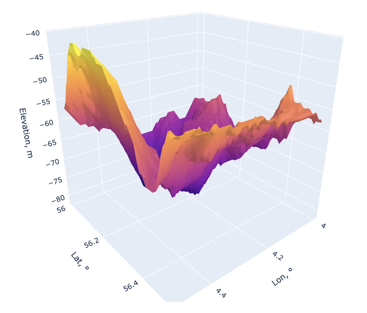
Example
Let’s select an squared area within the following coordinates:
Latitude from 56° to 56.5°
Longitude from 4° to 4.5°
>>> import petrodc.usgs_eros as elev
>>> lat_min = 56
>>> lat_max = 56.5
>>> lon_min = 4
>>> lon_max = 4.5
>>> elev_surface = elev.elevation(lat=(lat_min, lat_max), lon=(lon_min, lon_max)).plot().show()
Web Application
There is also the web-app based on petrodc: